Phoaly turns the GPS in your photo metadata into a map. Points are clustered by viewport and zoom, place names come from an offline gazetteer, and online map tiles can be switched off. The map still works without a network.
This page explains the feature and its privacy model.
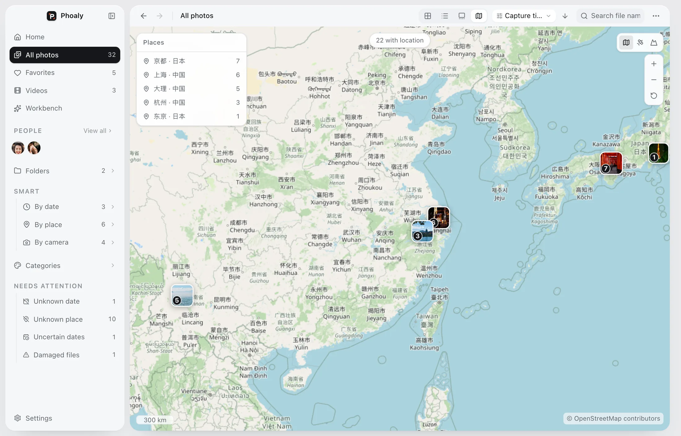
What it shows
- A point for every photo with GPS coordinates.
- Clusters that follow the current viewport and zoom.
- Place names for the city or region you are looking at.
- A photo footprint you can use to browse by location.
The map is a browsing surface, not a separate library.
How clustering works
Clusters follow the zoom. At a wide view, a trip becomes one cluster. Zoom in and the cluster splits into districts and individual photos.
That behavior matters for large libraries: 100,000 points should not collapse into one unreadable blob. The clustering is computed for the visible area, not for the whole library at once.
Offline place names
Place names come from a bundled gazetteer of 171,654 places. It names the city without a network request, and Chinese names are handled first.
This is the part that keeps the map useful on a plane or on a disconnected drive. The names do not depend on a geocoding API.
Online tiles are optional
Online map tiles are the only optional network request in the app:
- They send standard tile coordinates, nothing about the photo.
- They can be switched off.
- If a tile fails to load, the map falls back to bundled borders.
You can keep the map completely local and still browse by place.
Three maps, one basemap
The home footprint, the browser map, and the inspector map share one basemap. That keeps the visual language consistent and avoids three different notions of where a photo is.
The inspector map keeps its zoom when you change photos, so you can compare neighbors without re-zooming every time.
Privacy
GPS coordinates are read from EXIF and used locally. The app does not upload photo locations. Online tiles, when enabled, receive only the tile coordinates for the area you are viewing.
The app has no account and no cloud sync.
Limits
- Photos without GPS do not appear on the map.
- Phoaly reads location metadata. It does not write GPS into photos.
- The map is for browsing, not route planning or geotagging.
- Place names come from the bundled gazetteer, so very small places may not be named.
Frequently asked questions
Does the map need a network?
No. Place names come from the offline gazetteer, and online tiles are optional.
Does it upload my photo locations?
No. GPS is used locally. If online tiles are on, only tile coordinates are requested.
Can I add a location to a photo without GPS?
The app reads GPS from EXIF. It does not write location metadata.
Why are some photos missing from the map?
They have no GPS coordinates in their metadata, or the drive they are on is disconnected.